
Lay-by of the week: Ynys Môn special
View Larger Map
Steve writes, "Between Llanfairpwllgwyngyllgogerychwyrndrobwllllantysiliogogogoch and Menai Bridge there are two lay-bys. One is bigger and better than the other in my opinion. It sports views of many of the mountains of north wales (Carneddau, Glyders, Snowdon range [though not Snowdon itself I believe]), also the Menai Strait where you can see kayakers and little boats and the bridge built by Telford that gives the town Menai Bridge it's English name (it's called Borth in Welsh)."
Lay-bys of the week: Top & tail of Scotland
View Larger Map
The first is right at the top, on the north coast of Scotland at Heilam above the shores of Loch Eriboll, gazing from the top of one of the most violent upheavals in these islands’ prehistory - when huge blocks of crust were uplifted and pushed dozens of miles from the east. The peaceful view is that of the ‘foreland’ - the block that escaped all the pandemonium.
Far to the south on the Mull of Galloway - Scotland’s most southerly point - a road down the long peninsula leads to a car park with panoramic views of land and sea.
View Larger Map
British Volcanoes: Arthur's Seat, Edinburgh
Last time we looked at the remains of the caldera on the Ardnamurchan peninsula, a volcano that may have been the result of the same hotspot as Eyjafjallajökull but is, in any case, related by virtue of its eruption at the start of the rifting process which first opened up the Atlantic.
This time we are concentrating on a more urban setting, on a volcano that last erupted in the Carboniferous period (between 360 and 290 million years ago) in the middle of what is now Edinburgh. It would have looked very different then, when much of Britain was a tropical swamp and a kind of prototype dragonfly flitted around the marsh with a two-and-a-half foot wing span; when arthropods which bear a resemblance to modern millipedes reached lengths of over eight-and-a-half feet; when all of this gigantism was made possible by an atmospheric oxygen concentration not far from double modern levels.
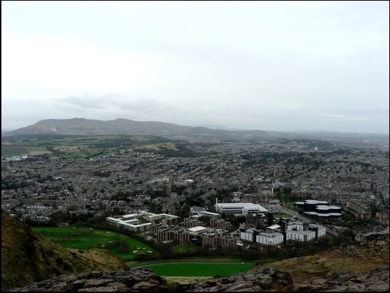
The view from the slopes of Arthur’s Seat
Around other parts of what is now the Midland Valley of Scotland, coal was being produced in the swamps of a coastal plain that was not unlike the northern shores of the Gulf of Mexico today (without the devastating oil-spill, of course). For 50 million years, this tranquil scene was occasionally interrupted by volcanic eruptions. First at what is now the Castle, then later in Holyrood Park, eventually forming the feature now known as Arthur’s Seat.
In the related volcanic activity that formed Salisbury Crags (below), however, the molten rock never actually made it to the surface as a volcanic eruption, cooling deep within the earth instead. By the way, if you live in London and don’t have a snowball’s chance in hell of getting to see Salisbury Crags or are simply too metropolitan to countenance travelling beyond the M25, the mountain has come to you instead. A lot of London is paved with it.
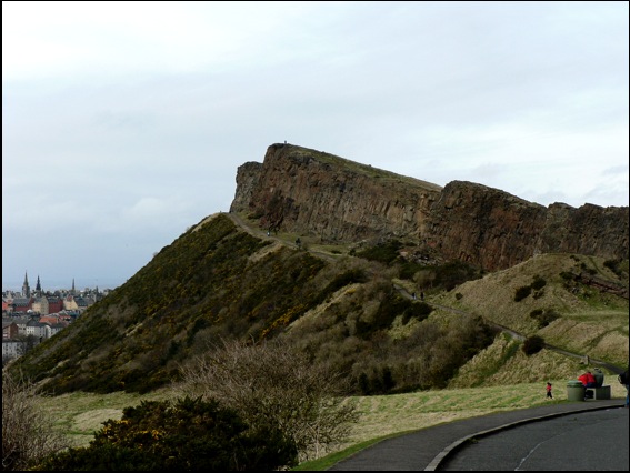 Salisbury Crags
Lay-by of the week: The double-yellow years
We’ve used this location because it’s a great view of Burgh Island, the Art Deco hotel that everyone from Agatha Christie, through Churchill and the Beatles have stayed at and the magnificent sand spit that connects it to the island. Caused by the refraction of waves around the island, this particular spit is a classic example of a tombolo.
View Larger Map
In Shetland, tombolos are known by their Norse word, ayre. At the romantically named Ayre of Swinister, two tombolos enclose a coastal peat lagoon known as the Houb.
View Larger Map
Iceland: a reminder of the power of the landscape.
Iceland, Eyjafjallajökull - May 1st and 2nd, 2010 from Sean Stiegemeier on Vimeo.
”So I saw all of these mediocre pictures of that volcano in Iceland nobody can pronounce the name of, so I figured I should go and do better. But the flights to get over took forever as expected (somewhat). 4 days after leaving I finally made it, but the weather was terrible for another 4. Just before leaving it got pretty good for about a day and a half and this is what I managed to get.
Wish I had more time. I missed all the cool Lightning and the Lava of the first eruption. But I figure this will just be a trial run for another day.
I am of course accepting sponsors to send me back there for more please...!! haha”
Music: Jónsi - Kolniður (http://jonsi.com)
Canon 5d mkII
HUGE thanks for the Motorized Dolly via MILapse (http://vimeo.com/milapse). Details are to come soon so stay tuned...
© Sean Stiegemeier | www.in-perfidia.com | www.twitter.com/sstieg
Less than three weeks to go...
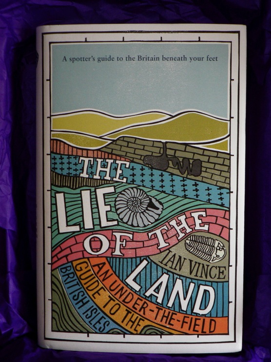
The Lie of the Land is published on the June 4 and Ian will be talking about it here and there over the next few weeks - keep an eye on the BLC website for more details of events in London and Devon among others, but in the meantime, we can reveal that he will be on BBC Radio 4’s travel magazine, Excess Baggage, on the morning of June 5.
You can order the book in all the usual places including Amazon, Waterstones and your local bookshop.
Members’ packs are on their way
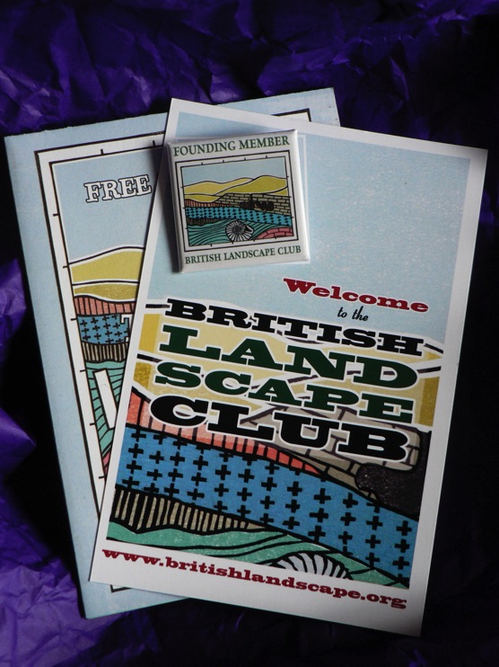
We’re delighted to let you know that the first raft of members’ packs, including the badges, are now on their way to BLC members up and down the country. If you haven’t yet given us your details, why don’t you do it now in time for our next mail-out early next week.
Non-members can now join without going through the palaver of subscribing to the members’ newsletter re:view. Just click on Members’ area above and send us your details direct.
Lay-by of the week: Kylesku, Highlands
The view is of Loch Glendhu stretching off into the distance while Loch Glencoul forks, unseen, behind the nearest headland to the right. The die-straight diagonal line on the mountain behind the lamp-post is the fault plane of the Glencoul Thrust, one of a number of landscape movements caused by the joining of Scotland - originally part of the same landmass as North America - to the rest of Britain over 400 million years ago. Land was folded, fractured then heaved dozens of miles from the west, from the north at Durness all the way down the west coast to the Isle of Skye.
View Larger Map
Although the ferry no longer carries traffic across the Loch to Kylestrome, there are still boat trips from Kylesku - most notably up Loch Glencoul, from where you can enjoy superb views of Eas a’ Chùall Aluinn, at 658 feet, Britain’s highest waterfall.
BLC Badges arrive
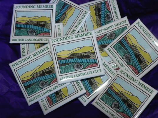 Members: We’ve just taken delivery of our lovely “Founding Member” badges which were, apparently, held up in some way by an unpronounceable Icelandic volcano. The irony of the business of the Landscape Club being held back momentarily by the actions of the landscape is not lost on us.
We only have a few hundred of these special “Founding Member” badges and there will be no more printed so if you haven’t already done so, send us your details to get your hands on one. Fill in the Members’ Area form and we’ll put one in the post to you for nothing, along with an exquisitely designed sample chapter from the BLC forthcoming manual, The Lie of the Land.
Non-members: You have to be a member of the British Landscape Club to get a member’s badge, any other way - we think you’ll agree - is madness. Membership - like the badge - is completely free and only requires that you sign-up for our occasional newsletter re:view. All we ever do is send you a link to where you may find it and we never, ever give, sell or otherwise divulge your email address or any other personal details to anyone.
Lay-by of the week: Chesil Beach from Portland
View Larger Map
You can get an even better view from the New Ground car park - follow the big arrow on the Street View below - but the Google car driver neglected to have their sandwiches in the lay-by that day.
View Larger Map