Britain’s Hidden Wonders in Countryfile

For further details check out the Countryfile Magazine website.
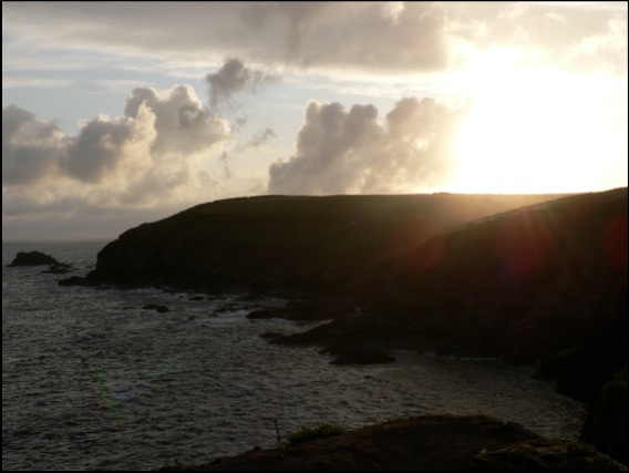
Northwest Highlands Google Earth fly-by
The complete tour takes about 17 minutes; if you are desk-bound for lunch, we’d recommend chomping your sandwiches as the Northwest Highlands float by underneath for a more relaxing break than might usually be the case.
We’ve kept it simple for now - no narration or music to accompany the scenery, but we might get bold in the future. We hope you enjoy the view.
Download Seventeen minutes in the Northwest Highlands.
Google MountainView 1
View Larger Map
This view, near the top of the winding lane that follows the Watendlath Beck from Derwent Water up to its eponymous Tarn, complete with lay-by encapsulates everything that is wonderful about the Lake District the glaciers left behind.
Applecross Cave discovered
The cave, near Applecross on the west coast, is 180 metres long and has stalactites measuring up to 2 metres. For Metropolitan types, that’s the length of ten bendy-buses, or Russell Square. More information at the link.
Layby of the Week: Llyn Cwm Bychan
View Larger Map
If your browser does not support Google Earth’s plug-in, you’re out of luck if you’re waiting for the Google Street car to arrive - this spot is simply too remote. Fortunately, the British Landscape Club have got there before you.
At the head of a remote valley and at the heart of the Snowdonia National Park, this Welsh lake sits at the centre of an eroded away dome - the Harlech Dome - of buckled rock that once bridged Snowdon in the north to Cader Idris in the south.
The lake is fed by the Afon Artro stream, the valley of which provides a mean transport corridor, enough for a hairy single track most of the way up from the village of Llanbedr on the coast road near Harlech. There’s a full account of its wonders in the Club manual, The Lie of the Land by Ian Vince, but all you need to know is that there’s a car park, a portaloo and moments of unfettered wilderness and blissful peace around this amazing spot.
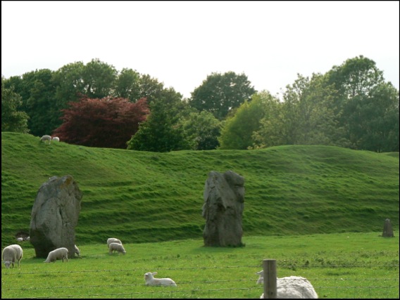
Layby of the Week: Silbury Hill
View Larger Map
If your browser does not support Google Earth’s plug-in, here’s a real view of Silbury Hill, taken from just down the road by the Google Street Maps car.
View Larger Map
Either way, it’s an impressive structure - Europe’s largest man-made hill, it rivals some Egyptian pyramids in size and was built over successive generations from about 2400 BC. It is located in a landscape of dip and scarp, gently undulating chalk downs occasionally punctuated by imposing escarpments.
The recently synthesized view is that Silbury Hill, successive excavations of which have yielded no burials, was constantly tinkered with by our Neolithic ancestors as a kind of devotional labour, perhaps commemorating their ancestors who laboured for thousands of years building a ritual landscape in and around nearby Avebury, the site of the largest henge in the world - itself a devotional labour of epic proportions.
There’s a layby and viewing area a little to the west on the A4.
A view of a tiny part of the henge at Avebury.
View Larger Map
An aerial view.
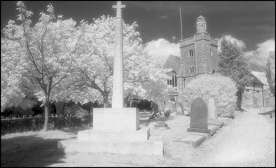
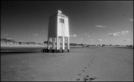
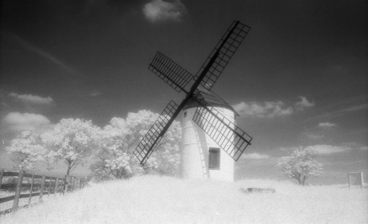
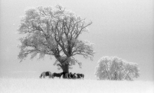
Infra-red landscapes II
Lay-by of the Week - St David’s Day Special
View Larger Map
These two shots were taken from approximately the same position and look up and down the valley. The rocks around this part of Snowdonia are a complex mix of mud and sandstones with volcanic tuff (ash) and all manner of igneous intrusions formed from magma cooled slowly underground.
Famous landscapes:
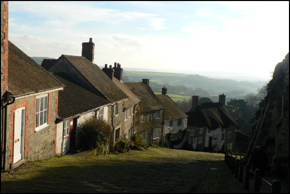
Gold Hill, Shaftesbury, Dorset
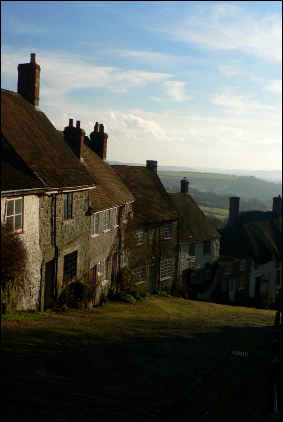
The views look south towards a landscape made from Cretaceous chalk and greensand and older mudstones and siltstones from the Jurassic period. To the west of Shaftesbury the Jurassic continues - with many of the same limestones that are found in the Midlands cropping up, lending the area its Cotswolds atmosphere.
Infra-red Landscapes
Landscape blog
On our occasional trawls around the internet in search of snippets to amuse we often find hardcore walking and rambling sites - all kit and kaboodle and useful instructions for getting a platoon to the top of a mountain. All well and good but, apart from the picture from the summit, the journey always seems more like a technical challenge than an engagement with the landscape.
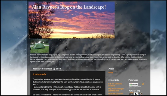
We were pleased, then, to find Alan Rayner’s Blog on the Landscape. Alan’s posts are illustrated with some thoughtfully composed photographs of this and that along the way - mostly natural features, plants and fungi - and his woodland shots, often difficult to capture well - are lovely.
Kit fetishists will be pleased to discover that Alan - an engineer by trade - appears to have designed and manufactured some of his own lightweight equipment and is always on the lookout for more, but a genuine love of the landscape permeates the blog. Recommended.
Lay-by of the week: Autumn Leaves
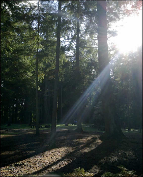
A special lay-by of the week this week from Bolderwood in the New Forest; not so much a lay-by as an interesting place to park, courtesy of the Forestry Commission.
View Larger Map
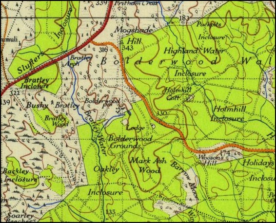
Ordnance Survey 1 Inch New Popular Edition 1945
During the summer months, the wildly interesting information kiosk (run-of-the-mill town centre TICs please take note) is open and on a busy weekend when the weather is nice you will often find an ice cream van parked up. But all of that is moot, because a short walk from the car park is a deer viewing platform - from where you may be lucky enough to spot a Red Stag or a group of Roe Bucks - like the picture below.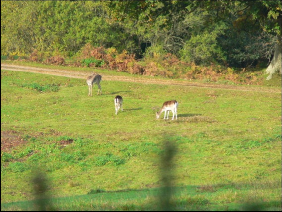
It’s also a timely reminder, as autumn passes into winter, of the importance of trees in the landscape, both from an aesthetic and functional view. Our forests are rich habitats that, like all woodland the world over, need to be managed and preserved not only for the good of some abstract ecological notion, but also because indiscriminate felling or management of them for anything other than their natural value is madness. The Coalition Government has recently announced it is to sell off up to half of our national forests. Not only would this put habitats and wildlife in severe danger, but it wouldn’t even raise very much money - making it all look less like a response to a financial crisis and more like an ideologically-sponsored privatisation; less like selling the family silver, more like putting our back garden up for sale. Anyone who cares about our landscape is strongly urged to join over 35,000 signatories (in the first week alone) and sign the 38 Degrees petition now - maybe they’ll think again when they see the numbers.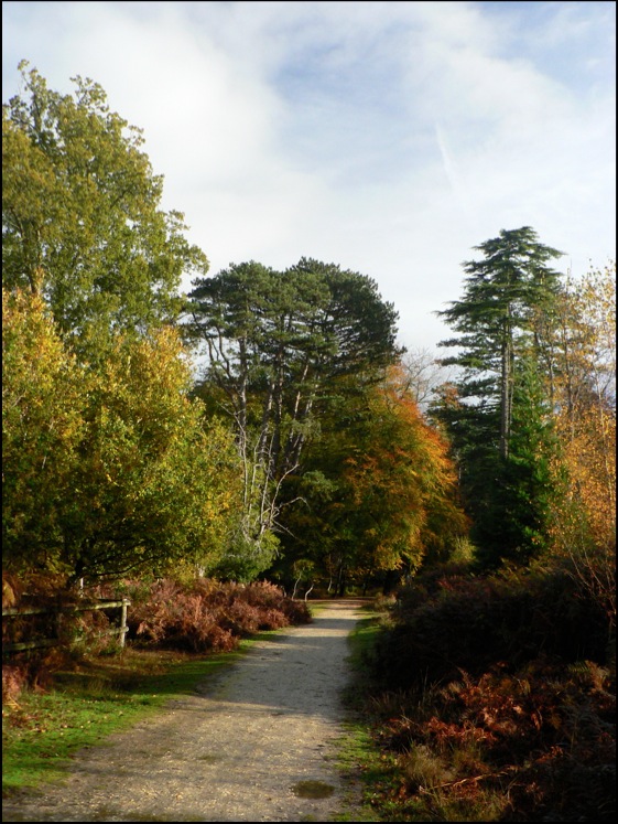
The Dabbler: The Lie of the Land
Lay-by of the week:
The Cow and Calf Rocks, Ilkley Moor
Overnight, a thick fog descended, but 35 people dutifully turned up to follow me around the Cow and Calf anyway, despite visibility beyond the end of one’s arms becoming difficult, so this week’s lay-by of the week is dedicated to the helpful folk of Ilkley and its environs.
View Larger Map
NB, For aesthetic reasons, the Googlecar is a little below the Cow and Calf car park in this shot.
Landscape appreciation
Lay-by of the week:
Porlock Bay and Selworthy
View Larger Map
If you’re driving on the A39, the road that connects the main towns of North Somerset and Devon, chances are you’re not getting anywhere very fast, so why not relax and make a detour to the village of Selworthy. This is the church car park in the village - rotate the panorama a little for a view of Selworthy’s beautiful white church.
View Larger Map
Lay-by of the week:
Loch Ness and the Great Glen
View Larger Map
The fault is a tear fault - the landscape to the north moved around 80 miles south-west then, in a second phase millions of years later, 18 miles back in the opposite direction. Loch Ness - which is, on average, around 600 feet deep owes its formation to the fault: glaciers carved out the trench from the band of shattered and pulverised rock left by it.
There is also strong evidence which links it to the Cabot Fault, which runs the length of the north west coast of Newfoundland and into the Gulf of St Lawrence. When the faults were formed, over 400 million years ago and long before the Atlantic Ocean formed, Scotland was part of the same landmass as Canada.
View Larger Map
Lay-by of the week: Symonds Yat
Again, it’s not, strictly speaking, a lay-by - more of a car park that leads to a view - but it’s only a very short walk and thousands come every year to see the view up and down the River Wye. It’s home also to Peregrine Falcons, Buzzards and Goshawks and is well worth the detour. It also makes an excellent place to watch the stars at night, according to some.
No Google Street View this time, but an OpenStreetMap image.
View Larger Map
Lay-by of the week: Cheddar Gorge
View Larger Map
The gorge was carved out in periglacial conditions during the recent glaciations of the current Ice Age. Though too far south to have had glaciers, water in the limestone from which the gorge walls are made, froze and rendered the normally permeable rock impermeable. Meltwater floods in the summer months flowed over the limestone and cut a deep channel which is the gorge we see today.
Dartington
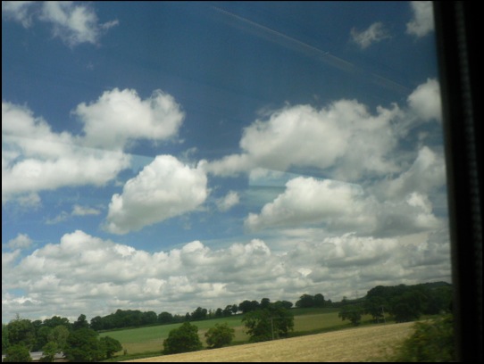
More pictures from trains
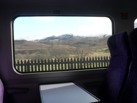
I’ve added a few more photos to the gallery of landscapes taken from trains. It seems like an unconventional way of capturing scraps of scenery as they zoom by and an excellent mental diversion when the novelty of getting out and about wears thin which, as any commuter on Britain’s railways will tell you, can be quite quick.
If you have some train pictures you want to share, feel free to add some in the comments below.
Lay-by of the week:
The Glen Café, St Mary's Loch
View Larger Map
The lay-by, meanwhile has just about anything you could desire, including a café, phone box, tourist information panel and fantastic views over St Mary’s Loch and it’s southern neighbour, the Loch of the Lowes. Looks like a charming spot. We’d give it a 4.5/5 Thermos rating, but there’s no need to bring one.
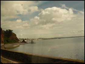
Lay-by of the week special:
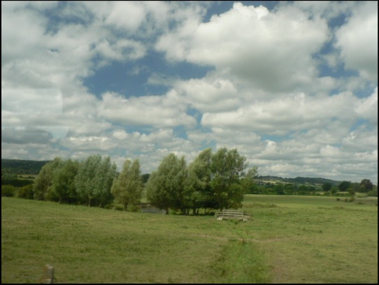
The views from a Devon train
The trains I travelled on were the Great Western 125 mph from Totnes to Exeter and the more modern but 90 mph from Exeter to Salisbury. On my way to Exeter, I was hoping to catch a good view of the fantastic New Red Sandstone cliffs around Dawlish, as featured in The Lie of the Land. I got something of it, through the fly carcasses, and it looks like an old double-exposed holiday slide that has been wedged under a shelf in the garage since the 1970s. It was, at least, nice to make something that came with an instant patina of age on a digital camera.
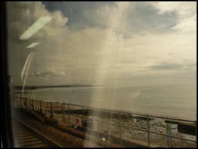
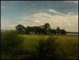
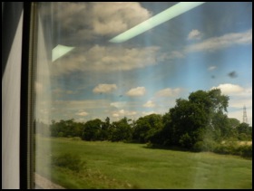
The second two shots are nearer Exeter, of clumps of trees on the Exminster Marshes. By the time that I had got on a cleaner train, I took some more presentable shots of the kind of thing you see from trains, this time mostly between Exeter and Yeovil. This first shot is of some trees in the Axe Valley - I’m hopeless at trees, but they’re in the right environment for Alder and Willow. I like the way they’re all leaning here, as if in agreement with one another.
The second shot is quite near Yeovil. The reflections from the train’s internal lighting give the sky some go-faster stripes.
Lay-by of the week special
ROAM: The London Lay-by Library
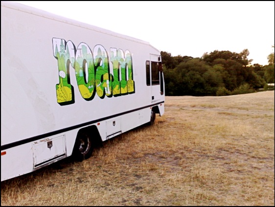
ROAM at Hollow Ponds, Whipps Cross Road
ROAM is touring the five Olympic boroughs of London over the next three weeks as a peripatetic arts space, a mobile reading room and a venue for talks and performance. It has its own reference library and comes complete with a proper parquet floor. It’s the idea of Caught By The River’s Robin Turner and fits well with that website’s general ethos of taking solace in easy, idle pursuits and looking for the rural within our urban lives.
I’ve already had the pleasure of taking the message of the British Landscape Club there and chatting about the Britain beneath its wheels and I’ll be doing it again three more times over the next week and a half, so come and join me.
Friday 9 July 3pm *NOTE NEW TIME*
Beneath Our Feet: Three Billion Years an Hour Through Britain’s Past
ROAM London: Haggerston Park • Parked up behind the tennis courts • E2 8NP
Friday 16 July 7.00pm
Beneath Our Feet: Three Billion Years an Hour Through Britain’s Past
ROAM London: Mile End Park • Grove Road • E3
*NOTE NEW VENUE* (Was at Truman Brewery)
Monday 19 July 7.30pm
Beneath Our Feet: Three Billion Years an Hour Through Britain’s Past
ROAM London: Oxleas Woods • Shooters Hill • SE18 3JA
Lay-bys of the week:
Cape Cornwall and Lizard Point
The text book definition of a cape, by the way, is a promontory where two major bodies of water meet - in this case the Atlantic and St George's Channel. Since those nineteenth century OS men declared Lands End as further out in the ocean it is arguably where the waters meet rather than Cape Cornwall, but the name stuck anyway.
View Larger Map
Meanwhile, there’s no such controversy about Lizard Point, mainland Britain’s most southerly spot. There’s a National Trust car park there as well and a bonus collection of sheds that sell souvenirs carved from the local rock. This rock, serpentine, is metamorphic in origin, 400 million years or so old, and an excellent example of a bit of oceanic crust that has unaccountably slid over the top of a piece of continent (it almost always slides under when the two collide).
You might like a cup of tea, while you contemplate that and, besides one of the souvenir sheds, lies the cafe with the best view in all of Cornwall (below). It’s always busy in the season and it’s always worth the wait. You may even be fortunate enough to see a couple of Cornish Choughs wheeling in the sky, failing that you can stare at the cliff that rings with the sound of Jackdaws and Kittiwake and hope to catch a glimpse of a Peregrine or two.
View Larger Map
Monstrous Carbuncle
But one of those towns – and not just any old market town, but Dorset’s county town – will never be the same again. For Dorchester has been tainted by its association with the monstrous carbuncle that is HRH Prince Charles’ Poundbury or, to give it a name accidentally arrived at in a Freudian slip of the tongue, Poundland.
View Monstrous Carbuncle in a larger map
This grotesque and repulsive display of architectural pus sits on the eastern horizon as you approach Dorchester from the west. The awful buildings infect the surrounding landscape with their weak-minded parody of a passing resemblance to a rough similarity to a half-remembered Tuscan hill-top village. Who-ever presided over this inferior and wholly unaesthetic effort should be shot through the lungs with high-velocity 2H pencils.
Some of Poundbury is well-executed, even if it is obviously the work of a cobwebbed mind. While the Duke of Cornwall proclaims his love of traditional vernacular architecture and actually has interesting and useful ideas about the sustainability of communities, his biggest showcase looks like a malformed bleb from the side of the A35.
Lay-by of the week: Askerswell from the A35
View Larger Map
One bright and crisp winters day a short breath after Christmas, we were driving through Dorset as we made our way back from Cornwall. The journey was quite familiar to me and I had never given it much thought. A couple of years before, I had come the closest to thinking deeply about travel when two friends and I covered the same ground as part of an epic, 15 mph journey across England in an electric milk float but, crucially we had picked a different route for this stretch.
I was on the A35, a murderously busy road we had escaped from while on the float - a quick turn-off that happened to land us in Arcadia, an enchanted valley near Little Bredy trapped somewhere between dusk and the early 1950s. It was the encapsulation of pastoral beauty and I will remember the scene for ever.
As so often happens in Britain though, by catching one thing, you miss another and the A35 - for all its homicidal ways - is the scene of something on a par with our Dorset Arcadia but in a different way. The stretch of it we avoided, between Dorchester and Bridport, affords awe-inspiring views of the lumpy, bumpy Dorsetshire hills, the festival of buxom hummocks that made it into the introduction to The Lie of the Land.
As ever, all attempts to capture such grandeur on a soul-less semiconductor fail miserably. I’ve taken my version of the Google Street View, but the best stuff is on the other side of the road when the road reaches its height and the views over the Dorset coast are breathtaking. You really have to see the view for yourself.
Lay-by of the week: Danebury hillfort
View Larger Map
Danebury is a magnificent Iron Age hillfort a few miles north of Stockbridge. There are two car-parks, the lower of which is clearly visible from the Google Street View car, but visitors can make their way further up the drive to a second parking area partially under the cover of trees. It’s then a short, moderately stretching walk (we did it with an off-roading pram, its occupant and an additional toddler on a hot day, so it obviously isn’t that difficult) up the hill to a large complex of banks and ditches. The outer banks are now topped by beech trees and surround a village-size area of almost level ground, perfect for kite flying and exploration.
The view from the Ordnance Survey trig point is amazing and well worth the walk up the hill.
Lay-by of the week: Ynys Môn special
View Larger Map
Steve writes, "Between Llanfairpwllgwyngyllgogerychwyrndrobwllllantysiliogogogoch and Menai Bridge there are two lay-bys. One is bigger and better than the other in my opinion. It sports views of many of the mountains of north wales (Carneddau, Glyders, Snowdon range [though not Snowdon itself I believe]), also the Menai Strait where you can see kayakers and little boats and the bridge built by Telford that gives the town Menai Bridge it's English name (it's called Borth in Welsh)."
Lay-bys of the week: Top & tail of Scotland
View Larger Map
The first is right at the top, on the north coast of Scotland at Heilam above the shores of Loch Eriboll, gazing from the top of one of the most violent upheavals in these islands’ prehistory - when huge blocks of crust were uplifted and pushed dozens of miles from the east. The peaceful view is that of the ‘foreland’ - the block that escaped all the pandemonium.
Far to the south on the Mull of Galloway - Scotland’s most southerly point - a road down the long peninsula leads to a car park with panoramic views of land and sea.
View Larger Map
British Volcanoes: Arthur's Seat, Edinburgh
Last time we looked at the remains of the caldera on the Ardnamurchan peninsula, a volcano that may have been the result of the same hotspot as Eyjafjallajökull but is, in any case, related by virtue of its eruption at the start of the rifting process which first opened up the Atlantic.
This time we are concentrating on a more urban setting, on a volcano that last erupted in the Carboniferous period (between 360 and 290 million years ago) in the middle of what is now Edinburgh. It would have looked very different then, when much of Britain was a tropical swamp and a kind of prototype dragonfly flitted around the marsh with a two-and-a-half foot wing span; when arthropods which bear a resemblance to modern millipedes reached lengths of over eight-and-a-half feet; when all of this gigantism was made possible by an atmospheric oxygen concentration not far from double modern levels.
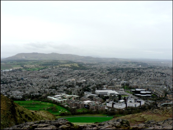
The view from the slopes of Arthur’s Seat
Around other parts of what is now the Midland Valley of Scotland, coal was being produced in the swamps of a coastal plain that was not unlike the northern shores of the Gulf of Mexico today (without the devastating oil-spill, of course). For 50 million years, this tranquil scene was occasionally interrupted by volcanic eruptions. First at what is now the Castle, then later in Holyrood Park, eventually forming the feature now known as Arthur’s Seat.
In the related volcanic activity that formed Salisbury Crags (below), however, the molten rock never actually made it to the surface as a volcanic eruption, cooling deep within the earth instead. By the way, if you live in London and don’t have a snowball’s chance in hell of getting to see Salisbury Crags or are simply too metropolitan to countenance travelling beyond the M25, the mountain has come to you instead. A lot of London is paved with it.
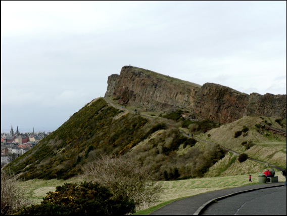 Salisbury Crags
Lay-by of the week: The double-yellow years
We’ve used this location because it’s a great view of Burgh Island, the Art Deco hotel that everyone from Agatha Christie, through Churchill and the Beatles have stayed at and the magnificent sand spit that connects it to the island. Caused by the refraction of waves around the island, this particular spit is a classic example of a tombolo.
View Larger Map
In Shetland, tombolos are known by their Norse word, ayre. At the romantically named Ayre of Swinister, two tombolos enclose a coastal peat lagoon known as the Houb.
View Larger Map
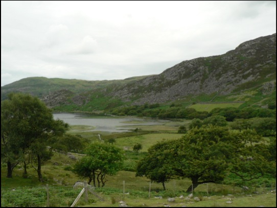
Lay-by of the week: Kylesku, Highlands
The view is of Loch Glendhu stretching off into the distance while Loch Glencoul forks, unseen, behind the nearest headland to the right. The die-straight diagonal line on the mountain behind the lamp-post is the fault plane of the Glencoul Thrust, one of a number of landscape movements caused by the joining of Scotland - originally part of the same landmass as North America - to the rest of Britain over 400 million years ago. Land was folded, fractured then heaved dozens of miles from the west, from the north at Durness all the way down the west coast to the Isle of Skye.
View Larger Map
Although the ferry no longer carries traffic across the Loch to Kylestrome, there are still boat trips from Kylesku - most notably up Loch Glencoul, from where you can enjoy superb views of Eas a’ Chùall Aluinn, at 658 feet, Britain’s highest waterfall.
Lay-by of the week: Chesil Beach from Portland
View Larger Map
You can get an even better view from the New Ground car park - follow the big arrow on the Street View below - but the Google car driver neglected to have their sandwiches in the lay-by that day.
View Larger Map
Win a hamper in our landscape photo competition.
To celebrate the launch of Lie of the Land, The British Landscape Club’s under-the-field-guide to the British landscape, we are running a photography competition to find Britain's best photographed landscape.
So get snapping those buxom hummocks, discordant coastlines and stone circles and submit them to the Lie of the Land Flickr photo pool at http://www.flickr.com/groups/lieoftheland/.
The winner - who will win a lovely picnic hamper - will be announced July 30 2010 Leading up to the announcement we will feature ten photos a week right here on the website. There will be also be runner-up prizes of signed copies of Lie of the Land.
For general competition terms and conditions go to:
http://www.panmacmillan.com/displayPage.asp?PageID=3823
Please be assured that your photos will only be used in connection with this competition and any publicity it generates - which may include the websites of national and local newspapers. The submitter retains all copyright to their photos and the right to a byline/credit where ever it is used.
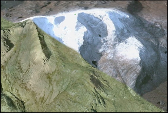
British Volcanoes: Ardnamurchan
At the risk of sounding like a Travelodge brochure, Britain’s volcanic heritage can be discovered in many locations across the UK from the wilds of Ardnamurchan to the slopes of Snowdonia - there are even city centre volcanoes for your convenience. We’ll be looking at all of these over the next few weeks, but we’re starting at mainland Britain’s most westerly point - not Land’s End as is popularly supposed, but the Point of Ardnamurchan in Scotland.
View Larger Map
The Ardnamurchan Peninsula, seen here courtesy of Google, was the site, around 65 million years ago, of intense volcanic activity. Over a period of approximately three million years, the Ardnamurchan volcano would have undergone a series of awe-inspiring eruptions culminating in the collapse of the cone and crater onto the chamber of molten rock beneath, forming the caldera - the remains of which we see today. The hotspot that created it may even be the same plume that now lies under Iceland obstructing your travel plans.
In the intervening period, wind, rain and, the most destructive of them all, glacial ice, have worn down the landscape. The following image is from the southern part of the crater itself, while the view north - like most of the journey along this road - is obstructed by the lie of the land.
View Larger Map
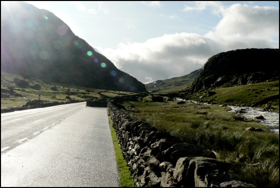
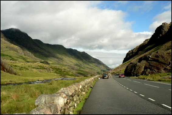
Lay-by of the Week: Llyn Ogwyn
View Larger Map
Steve writes, “There are several lay-bys on this stretch of the A5 which are very popular with outdoorsy people. Looking west you can see Y Garn which has a nice cwm. and SSE you can see Tryfan, probably one of the best mountains in Wales. You can also see Llyn Ogwen, the lake alongside the road. You might prefer the lay-by closer to Ogwen Cottage as you can get a cup of tea there.”
Feel free to re-tweet the permalink and, as ever, if you have a favourite stopping-off point to view the scenery over a cup of warm thermos tea, drop us a line or leave a note in the forum.
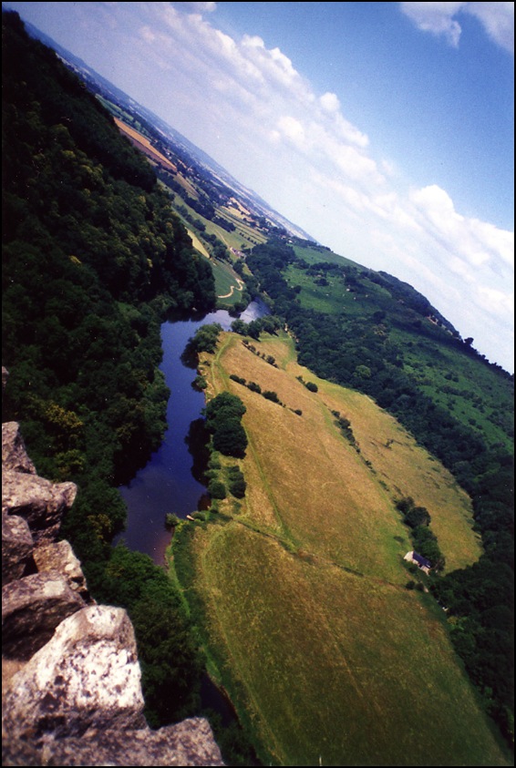
Lay-bys of the Week: Ravenscar and the Hole of Horcum
View Larger Map
Further inland, on the A169 between Whitby and Pickering, lies the stunning vista of the Hole of Horcum - a spectacular, 400 feet deep natural amphitheatre, three-quarters of a mile across formed by glacial ice.
The Hole of Horcum is the first place in Lay-by of the Week to be close to one of those top-secret, hush-hush places perfectly visible to anyone with some petrol money and a valid tax disc, but shrouded in the strangely impenetrable Googlemist for virtual passers-by. It's incredibly foggy for about 50 yards outside the Yorkshire "RAF" base and none of the usual Street View navigation controls work. Presumably, if you stick around for too long, some men in balaclavas will crash through your ceiling and confiscate you. Stick to looking at the Hole of Horcum, if I were you. Lay-by rating 4/5.
View Larger Map
Lay-by of the Week: Passing Place special
View Larger Map
Lay-by of the Week: Laxford Bridge
So, another week, another lay-by, but this isn't any normal picturesque view but one which labours under the name of the Multi-Coloured Rock Stop. Some might find the joviality annoying but arguments about the presentation of science aside, the Multi-Coloured Rock Stop is an astounding feature. Three different ages of rock can be distinguished on the cutting opposite this layby and even the artefacts left behind by the road contractor's rock drills, the regular parallel incisions down the rock face, only add to the effect.
View Larger Map
The oldest rock here - the pale grey one - is one of the ancient Lewisian Gneisses of the North West Highlands, a rock that was brewed at high temperatures and under great pressure miles underground billions of years ago. Swirling across it with the twisted teardrop freedom of a Paisley pattern, is a dark brown-black basalt which, as molten rock, squeezed through a weakness in the gneiss. Finally, streaks of pink granite cut through both the gneiss and the basalt dyke and so must be the youngest of all three.
Human landscapes
Meanwhile, an article from last Monday's Times takes us to Maiden Hill in Dorset, the remains of a huge Iron Age hillfort a mile or two to the south west of Dorchester, to report that the coldest winter in 30 years has left the landscape 'burnt brown by frost'. Which is all true: pity though that the picture desk bought a slide of somewhere completely different to illustrate the article. 'Children enjoy the snow in Maiden Castle, Dorset, last month' runs the caption, under a picture of Gold Hill in Shaftesbury, perhaps more famously known as the location of the Hovis ad but, as completely missed by the Times' editorial team, 30 miles to the north of Maiden Castle.
Lay-by of the Week
View Larger Map
If you pan to the right, you'll see the lay-by itself. Further down the A498 there is a closer view of Llyn Gwynant on a sharp bend of the road and excellent views up the valley - an enchanting vista on a fresh spring morning.
View Larger Map
View up the Gwynant Valley.
Google Stone View
View Larger Map
Armchair travellers will be delighted to hear that there will be more coming up from Google Street View in due course. You can see a lot of interesting landscapes all over the UK and, although you should tramp out across them rather than admire them from afar, some of the locations make ideal spots to stop on long journeys.
Stonehenge Landscape
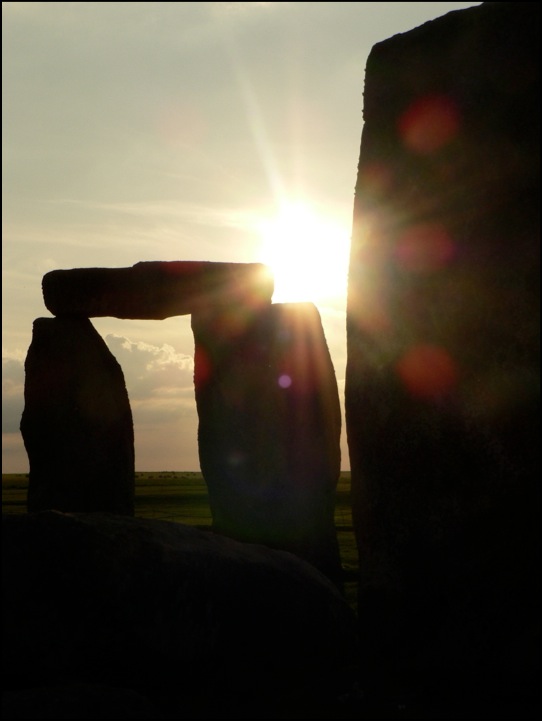
The writer pays a visit to the Stonehenge Cursus and The Avenue and concludes that the surrounding landscape was manipulated by the builders of the henge to evoke a sense of wonder.
Here is a link to the online version of the article.
